Most Lawrence people are familiar with Clinton Lake, and the associated State Park and perhaps the Marina, but the wildlife Refuge along the west arm of the Lake and the Wakarusa River are worth a visit because it gives a nice glimpse of what the Wakarusa valley must have been like before Clinton dam was built. Plus, there is lots of new habitat amidst the mixed deciduous forest.
My son Norman has been there several times and we decided to spend a quiet afternoon, hiking and talking.
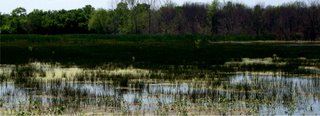
This image shows a bit of swampy area formed when a creek flowing into the Wakarusa is interrupted by a dirt road leading to a nice fishing area.
 There are a number of maintenance roads, worth hiking along, one of which leads to a new marshy area, quite extensive. We saw great blue herons, unfortunately too far away for me to get pictures.
 Much of the surrounding land appears to be leased by farmers, who are just planting now. But I don't know what is planted here. We scared up several several snakes. What is really nice here is that you are so far from the main lake that you cannot hear the sounds of cars or motorboats; just the birds.
 My camera doesn't take good closeups but I end with some buggy pictures. This first one is a sweat bee, I believe an Augochlora, a beautiful metallic green bee. In addition in some of the open areas there were beautiful green tiger beetles, but they were too fast for me to snap.
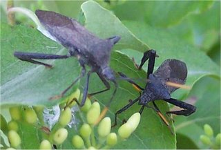
 Here are some leaf footed bugs on dogwood. Very impressive bugs indeed; they must have been 3/4 inch long!
 A cool spider we found under a log. I am not sure what kind, but she's pretty good size!
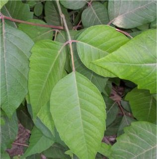
Obviously this part of the lake is not everyone's cup of tea. Indeed if you don't know what this plant is, you probably ought to stay away.
 To get to this part of the lake, go south over the dam to County Road 458 and follow that around to the West side of the lake. Just after the second bridge over the main west arm of the lake, 458, jogs left. There is a not too obvious brown sigh that says Clinton Wildlife refuge. Follow 100E South as far as you can go.
 This map shows the spot. We were on the North side of the river around Coblentz marsh. Also the map shows 100 E going over the river but I wouldn't count on that. If you want to go to the boat ramp. Looks like 1023 to 950N is your best bet.
For those not so familiar with the Clinton Lake area and not into the sort of creative driving(As my wife calls it) that I enjoy the complete map is at the Clinton Lake Project home page.
Other links:
http://baldwin-city.com/rec/clintonlake/
Good overview of the Clinton Lake area from the Baldwin City website.
http://douglasnewcomers.lawrence.com/parks.html
Another overview from Douglas County.
http://www.naturalkansas.org/neks.htm
Good maps of areas for wildlife viewing.
http://www.emporia.edu/earthsci/student/schmidt2/wetland.html
A student written review of the Wakarusa Valley and associated regions.
The aerial overview is worth reproducing here:

http://www.kansas.sierraclub.org/Issues/SLT/SouthLawrenceTrafficway.htm
East of Clinton Dam, land use along the Wakarusa is a big issue as this
link from the local Sierra Club discussing the 'South Lawrence Trafficway', shows.
Technorati Tags:
Kansas
Hiking
No comments:
Post a Comment